 Can I Cast It?
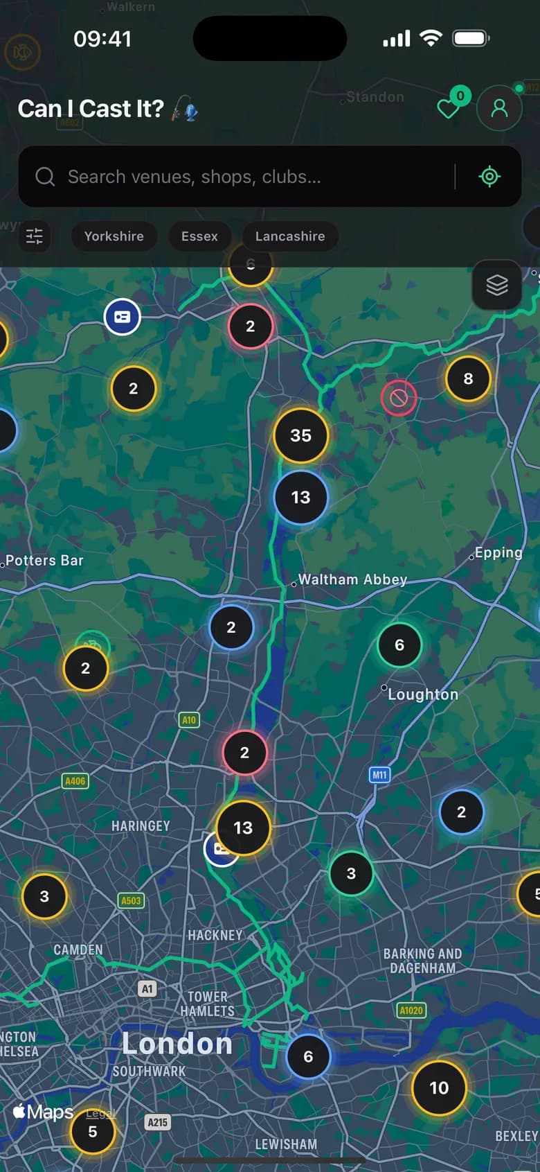
Only 143 venues are free. Know which.
Every one of 5,742 venues carries its real access state, so you find out before the drive whether you can fish it.
- OPEN
- 143 2.5%
- PERMIT
- 3,661 63.8%
- MEMBERS
- 1,431 24.9%
- PRIVATE
- 507 8.8%
- 01
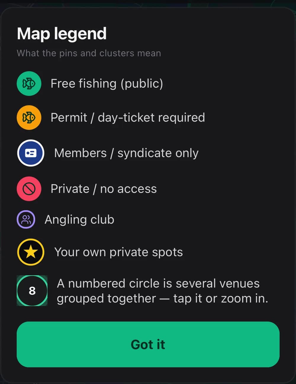
Free fishing
Public water and free stretches, including Canal & River Trust towpaths. Turn up, keep to the byelaws, fish.
NEED / ROD LICENCE ONLY
- 02
Permit / day-ticket
Association and club water you can fish on a ticket. The venue names the controlling club and links its phone number.
NEED / ROD LICENCE + DAY OR SEASON TICKET
- 03
Members / syndicate
Club-controlled water open to members only. A membership marker on navy, so it never reads as day-ticket access.
NEED / ROD LICENCE + MEMBERSHIP
- 04
Private / no access
Strictly private water. Marked so a wasted drive never turns into an awkward conversation on someone's bank.
NEED / SHOWN FOR REFERENCE ONLY
Then narrow it to the water you would actually drive to.
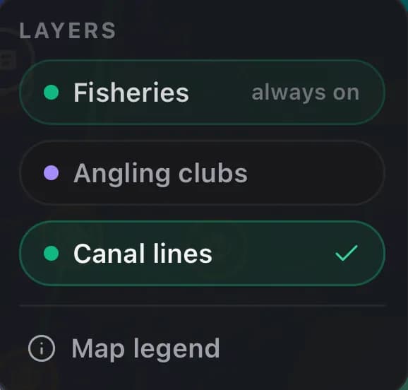
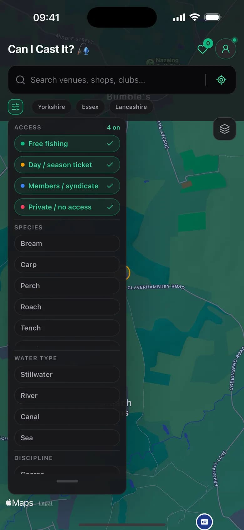
Switch access states off one at a time, filter by species or by stillwater, river and canal, and toggle the angling-club and canal-line layers on top. The legend is one tap away, so nobody has to memorise what navy means.
Fisheries and stretches, each carrying its own access state and rules
Angling clubs, with the nearest one surfaced on every venue
Tackle shops, mapped alongside the water they serve
Canal navigations drawn as lines you can follow, not just pins
Drawn from Angling Trust data covering 110 counties of England and Wales. It travels inside the app, so the venues and rules work with no signal. The map imagery underneath does need one.
Six things it does, and does now.
Nothing on this list is coming soon. Every one of them is in the build on the App Store today.
- § 02.1
Works where there is no signal
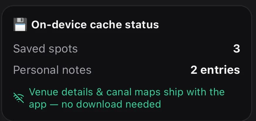
Venue details, access rules, canal lines and your own notes ship inside the app. There is no pack to download and nothing to remember before you leave the house — it is simply already there.
- § 02.2
One search across everything
Fisheries, angling clubs, tackle shops, canal navigations and your own private spots sit in a single index. Type two letters; every result tells you which kind it is.
- § 02.3
The nearest club, on every venue
Open a stretch and you get its access state, the rules in plain words, the species people target, and the closest angling club — with a number to ring and a site to check.
- § 02.4
A journal that stays yours
Log what you tried, what worked, and a photo of the peg. Notes are written to your phone and stay there: no account to make, no email to hand over, nothing uploaded to us.
- § 02.5
Licence wallet
Keep your Environment Agency rod licence and club tickets on the phone, findable in two taps when someone asks — with or without a connection.
- § 02.6
Spots only you can see
Drop a pin on the peg you found yourself. It gets a gold star on the map, sits alongside the public data, and never leaves the device.
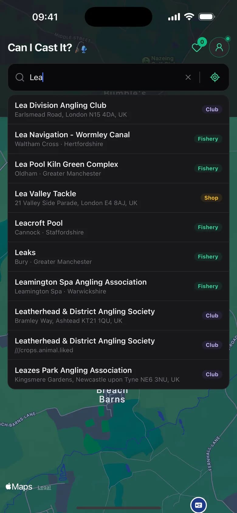
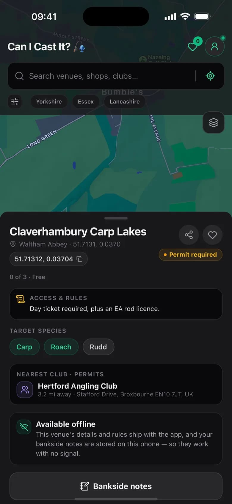
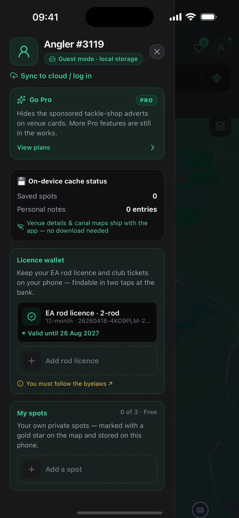
The app's own cache panel says it plainly: venue details and canal maps ship with the app, so there is nothing to fetch before you leave the house.
See it work, start to finish.
The demo made for RevenueCat Shipaton 2026. The whole app was built solo by Josh Thomas-Houlker.
Straight about what it doesn't do.
An app that oversells itself wastes your Saturday. So here are the limits, in the same size type as the features.
Base maps still need a signal
The venue data, the rules and the canal lines are bundled in the app. The map imagery underneath them comes from Apple Maps, and that is not.
There is no cloud sync yet
Everything lives on your phone, which is the point — but it also means a new handset starts empty. Sync is not built, and the app says so rather than hiding it.
No live catch reports
We have no crowd of anglers filing bankside updates, so there are no bait scores and no "3 reports today". When there is real data, there will be a feature.
Public data, not gospel
Access is assembled from public sources and can change without telling us. Treat the app as the best available picture, then check locally before you cast.
10% of every subscription is committed to work already underway.
We are not starting our own scheme. A fixed tenth of subscription revenue is committed to the clubs and river trusts delivering habitat and access projects on the water you fish — the same kind of work the Environment Agency funds from rod licence income through its Fisheries Improvement Programme.
The conservation card in the app reports what has actually been allocated. No allocation has been made yet, so today it reads zero — and it will show the real figure once one is. Those projects run on volunteer time and match funding from local clubs, so a small contribution goes further than it would on its own.
If the water gets worse, the app gets less useful. Fixing it is not marketing, it is maintenance.
Figures published by the Environment Agency for its Fisheries Improvement Programme. These are the programme's results, not ours — they show the kind of work a contribution helps pay for.
The map is free. All of it.
No venue is behind a wall and no account is required. Pro raises the limits on what you can save and takes the sponsored cards away.
Free
Forever, with no sign-up and no email address.
- The whole map — all 5,742 venues, no walls
- Access state and rules on every stretch
- Search across venues, clubs, shops and canals
- Bankside journal and licence wallet
- 3 saved spots
- 3 private spots of your own
Venues carry a sponsored card for the nearest tackle shop. It comes from the same bundled dataset as everything else — there is no ad network in the app.
Pro
Save 30% annuallyor £24.99 a year — £2.08 a month
£2.99/month after that unless you cancel. The annual plan has no trial. Apple's purchase sheet shows the trial terms before you confirm.
Cancel any time from inside the app (Manage subscription) or in your App Store settings.
- 10 saved spots, up from 3
- 10 private spots, up from 3
- No sponsored tackle-shop cards on venues
- 10% of the subscription committed to waterway projects
More Pro features are still in the works — we won't list them before they ship.
Prices are UK App Store prices. An Environment Agency rod licence is still required by law to fish in England and Wales, and is not included.